Begin with a route survey
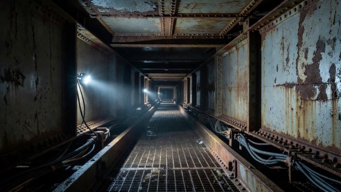
Before selecting a crawler, drone, climbing device or remote camera, map the target and the path to it. Record the component’s position, dimensions, surface, obstructions and required viewing angle. A useful route plan includes where a platform starts, where it turns, how it crosses joints or changes in elevation, and what happens if it loses power, adhesion, communication or propulsion.
Existing drawings help but may not show later services, repairs, debris or coating changes. A walk-through, safe vantage-point survey or prior inspection record can expose practical constraints. Owners should identify load limits, access permissions, lifting points and any restrictions imposed by rail, road or water operations. The survey should also distinguish required coverage from optional imagery: limited access may justify a targeted task, not a claim of complete inspection.
Match the machine to its surface
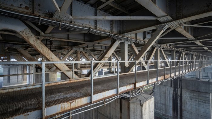
Magnetic crawlers can be effective on suitable ferromagnetic steel, but their performance depends on thickness, curvature, coating, corrosion, weld geometry and the condition of the contact surface. A magnet may hold on a clean plate and still struggle at a flange edge, stiffener transition or heavily layered paint. Verify the substrate and test representative surfaces where practicable. Do not assume a device designed for a flat plate can negotiate a complex box girder.
Wheeled or tracked platforms may work on broader horizontal surfaces and can carry multiple sensors, but gaps, cables, cross frames and abrupt steps can stop progress. Climbing systems may follow selected faces or ropes but bring anchoring, tether management and retrieval questions. Remotely piloted aircraft can inspect exposed faces quickly, yet close proximity can create collision risk, turbulence and image blur; flight permissions and pilot competence remain essential. Under-bridge inspection units, scaffolds and rope access are not robots, but they can provide a more appropriate reference or complement when robotic access is unsuitable.
Geometry, weather and traffic set the useful window
Dimensions on a drawing do not equal clear operating space. A camera and chassis require turning room, a sensor needs a useful angle, and a tether needs a route that will not snag. Narrow gaps may hide the target from a forward camera. A complicated underside may divide the task into separate zones with different access methods. Water level, vessel movement, road spray, dust, vibration, temperature and wind can shorten a deployment window or degrade observations. Specify operating limits for the complete system, not only the vehicle.
Traffic management is equally practical. A machine may avoid placing a person under a bridge but still require lane closures for launching, recovery, spotters or safe exclusion zones. Railway possessions, navigation restrictions and local permits may dominate the schedule. Plan access with the asset owner and relevant operators early; late approval can make an otherwise suitable platform unusable.
A method for comparing options
- Define the inspection target. Name the component, suspected condition, required resolution and evidence expected.
- Describe the route. Note surface, transitions, reach, obstructions, launch and recovery points.
- Check operating conditions. Confirm weather, visibility, communications, traffic interfaces and permissions.
- Test failure recovery. Explain how the device will be retrieved after a fault without creating a greater hazard.
- Set boundaries. Mark inaccessible areas, alternate methods and the point at which work stops.
Keep access claims proportionate
“Can reach” is not the same as “can inspect.” A platform may physically arrive but lack stable positioning, adequate lighting, sufficient sensor angle or the ability to capture repeatable data. A route can be technically possible but operationally poor if recovery is hazardous or the record cannot be tied to a component. Assess the whole job: safe deployment, usable observations, traceable location, recovery and handoff to the engineering team.
For difficult structures, the strongest plan may combine methods: aerial overview, crawler close-up, human verification at selected points and conventional testing where a concern requires confirmation. The owner should receive the coverage map and explicit gaps. That makes an access limitation visible and creates a defensible basis for the next inspection step rather than an implied all-clear.